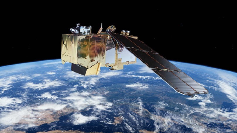
Source: ESA/ATG medialab
Effective environmental protection, climate monitoring and also the early detection of natural disasters require comprehensive data and information, which can be collected, consolidated and evaluated by deploying modern earth observation and information technologies. In Copernicus, the European earth observation programme (formerly known as GMES), the European Union, working with the European Space Agency (ESA) and the European and national systems, has created an independent, high-performance earth observation infrastructure, the only one of its kind worldwide.
Copernicus pools satellite-based geospatial information from the Member States collected throughout Europe. The specific focus is on closing existing information gaps.
Policymakers, the general public, the public authorities, industry and the research community are highly dependent on comprehensive and up-to-date information on the state of the environment. In Germany, efficient measuring networks are operated to continuously collect high-quality meteorological, hydrological and geodetic parameters. These data are of special relevance for services of general interest. However, measurements of the air quality, such as concentrations of ozone and fine particulates, the water level of rivers, snow depth or wave swell also play an important role in everyday life. Satellite-based earth observation systems like Copernicus are of special importance for the production of uniform, up-to-date data sets covering all areas on a cross-border level.
An increasing need for environmental information also results from international commitments, as for example European legislation, the Framework Convention on Climate Change (UNFCCC) or the Kyoto Protocol.
Copernicus services
The core of Copernicus is formed by information services which analyse, process and make available earth observation information to political decision makers as well as European, national, regional and local users. The core services provide standardized multi-purpose information that is important for numerous different fields of application in which the EU operates. They also provide support to players from European institutions in the development, implementation or monitoring of European policies or in their participation in international commitments.
- Emergency Management
Objective: providing information to improve the ability to respond to disasters and to support emergency services.
- Land Monitoring
Objective: providing information on land cover and land use and on changes to the surface of the land for urban planning, urban development, soil sealing and other purposes.
- Marine Environment Monitoring
Objective: providing information on the state of the oceans, coastal regions and for shipping (e.g. ice service).
- Atmosphere Monitoring
Objective: providing information on atmospheric composition to monitor air quality and the implementation of international agreements (such as the Montreal protocol on chlorofluorocarbons (CFCs)) as well as the impact of such agreements.
- Climate Change Monitoring (in progress)
Objective: establishing climate information services.
- Security (in progress)
Objective: surveillance of the EU’s external borders and maritime surveillance.
The space component of Copernicus
Environmental changes are not confined to national borders. Satellite systems are essential for obtaining the comprehensive and uniform set of basic data on a global scale which is required for global environmental monitoring. The ambition of establishing independent access to global earth observation data therefore characterizes the outstanding importance of the satellite-based earth observation of Copernicus.
The Sentinels, satellite missions specifically developed for Copernicus, are the centrepiece of its space component. Additional missions, mainly from national space flight programmes, commercial European missions as well as the meteorological missions of EUMETSAT collect other important data for the Copernicus services. Germany makes a considerable contribution to the funding of the space component.
The ESA Sentinel missions are the outcome of a demand analysis which takes account of the ongoing missions and the requirements of the Copernicus core services:
- Sentinel-1: All-weather, day-and-night radar imaging.
- Sentinel-2: A multi-spectral optical sensor with an average spatial resolution. The observation of land cover and land use, in particular, is based on its data.
- Sentinel-3: Measurements of the colour, surface temperature and surface height of the oceans.
- Sentinel-4 and Sentinel-5 (incl. Precursor): Instruments to monitor the atmosphere (greenhouse and trace gases, air quality, ozone and solar radiation).
- Sentinel-6: High-precision and timely observations of the sea levels.
The programme entered its operational phase when the first Copernicus Satellite Sentinel-1A was launched and the European Copernicus Regulation entered into force in April 2014.